
Celebrating 250 Years: Juan Bautista de Anza Expedition and United States Semiquincentennial
Thámien: The Original People of Cupertino
Introduction
For thousands of years before 1775, the Santa Clara Valley, later nicknamed "the Valley of Heart's Delight" and "Silicon Valley," was home to a large and highly developed Indigenous population. These people called themselves Thámien. Their neighbors included the Ramaytush of the Peninsula, the Chochenyo of the East Bay, and the Awaswas, Mutsun, and Rumsen to the south — all speakers of Ohlone dialects, a language family spanning from Vallejo in the north to Monterey in the south. Today their descendants belong to tribal nations including the Tamien Nation, Muwekma Ohlone, and Amah Mutsun, who continue to pass down their traditions and histories.
"Long ago, it was said that Eagle, Coyote, and Hummingbird watched from the mountain tops the water recede after the great flood. Eagle, The Chief, sent Coyote to see if there was land below. Coyote returned and announced that 'the land is dry.' Afterwards, Coyote made all the Indian people of California. He made the Muwekma (The People) of the Santa Clara Valley. Together the Muwekma, Eagle, Coyote, Hummingbird and all the other animals shared this great and beautiful valley."
-Muwekma / Ohlone creation story
Ceremony & Spiritual Life
Since the 11th century, the Ohlone have been the southernmost peoples to participate in the northern Californian Kuksu religion, facilitating widespread interaction between peoples of the Bay Area and Central Valley. Ceremonial dances performed in regalia at sites of spiritual importance enact mythic dramas and world renewal. Sacred places such as cemeteries and natural sites are marked by poles hung with feathers, regalia, and food offerings; arrows stuck point-first into the ground nearby served as symbols of peace. Mt. Umunhum is one such sacred site connected to the Thámien version of the Great Flood narrative.
"On passing near the village…we saw on the edge of it something like a cemetery. It was made of several small poles…on the poles were hung some things like snails and some tule skirts which the women wear. Some arrows were stuck in the ground, and there were some feathers which perhaps were treasures of the persons buried there."
-Father Pedro Font, expedition diary, near modern-day Gilroy, 1776
Food & Economy
Though the Thámien practiced little to no agriculture before missionization, they maintained large populations and extensive trade networks through skilled management of the region's rich environment and formed lifelong "special friendships" across villages to facilitate long-distance trade. Thámien and other Ohlone people strive to continue their dietary and cultural practices today. Acorns are a staple food, ground into meal after leaching out tannins. Tule is used for houses, boats, baskets, and clothing. The soap plant yields soap, glue, and a salve for poison oak, the list goes on. The Thámien hunt, fish, and practice cultural burning to manage the land.
Social Structure
High-status families across the Bay Area and Central Valley maintained relationships through carefully observed customs, organizing mourning ceremonies, dances, weddings, and trade feasts. Children were sent to live with neighboring groups to strengthen ties, creating kinship networks that supported complex political, economic, and cultural structures across the wider region. The Ohlone were widely known as gracious hosts who treated strangers with generosity and goodwill. These cultural norms would greatly shape how the Ohlone would come to deal with Spanish colonization.
Prelude to De Anza: Early Expeditions to California
Introduction
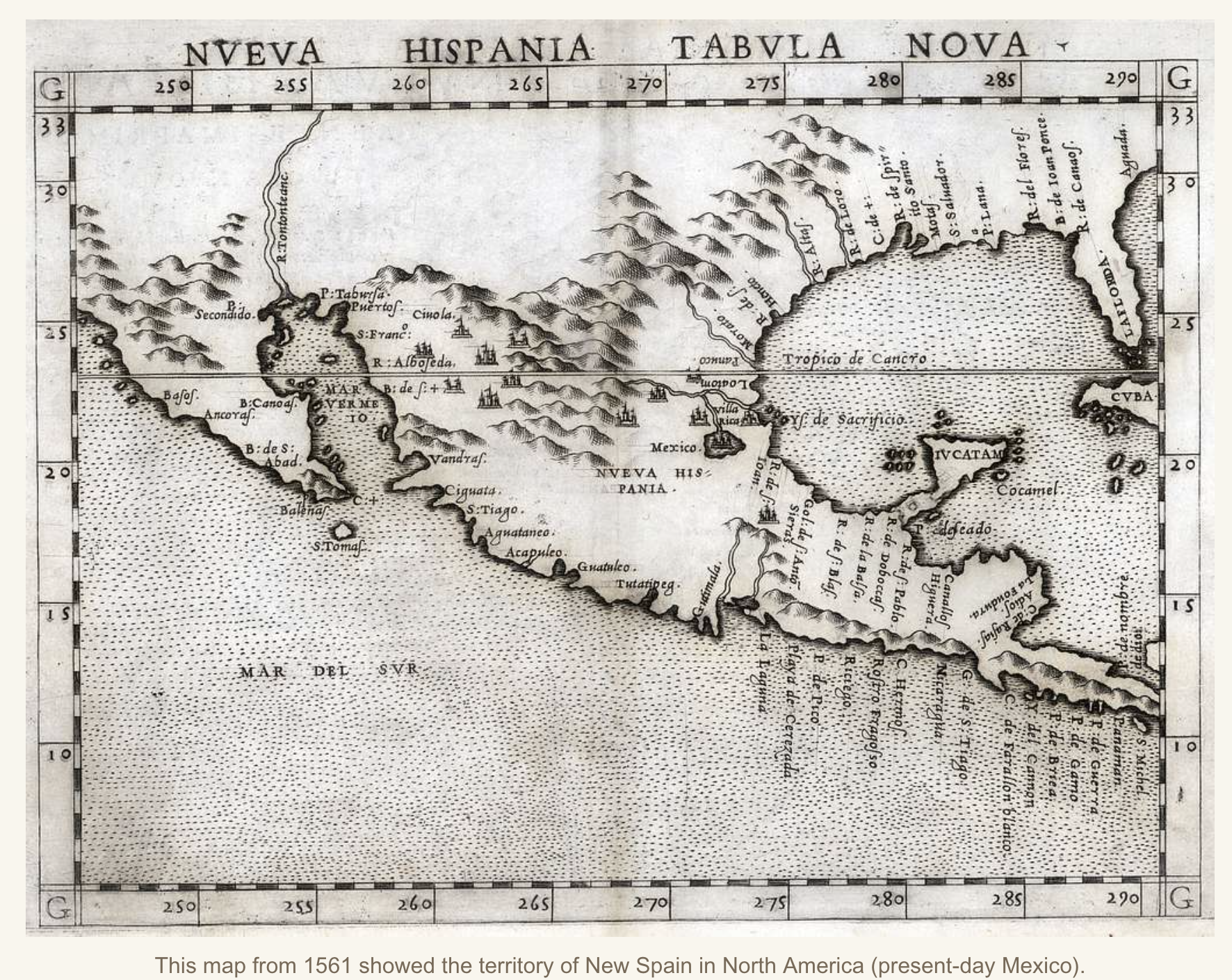
Spanish interest in California stretched back over two centuries before De Anza's expedition.
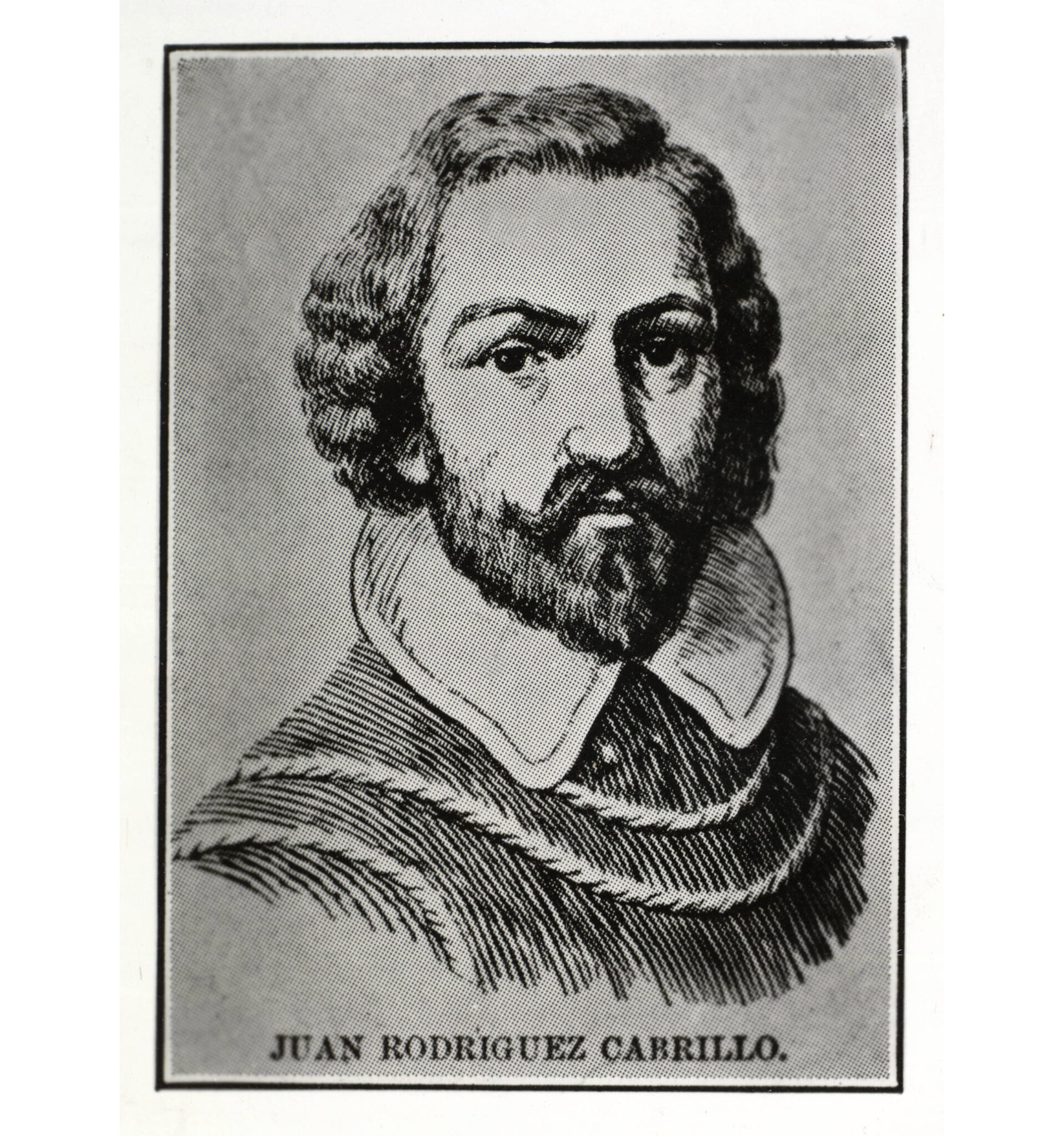
In 1542 , Portuguese mariner under Spanish employ João Rodrigues Cabrilho (1497–1543) mapped the Pacific coast as far north as Bodega Bay, but failed to spot the Golden Gate, likely obscured by its persistent fog that would keep San Francisco Bay hidden from Europeans for more than two hundred years.
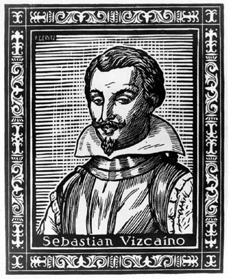
In 1602, Sebastián Viscaíno (1548–1624) mapped the coast in greater detail, bringing Monterey Bay to the attention of the Spanish king as a potential port for Trans-Pacific trade. Plans to colonize California were shelved for another 160 years. The Spanish crown eventually ordered colonization in response to the southward expansion of the Russian Empire along the Pacific coast, seeking to create a buffer between the Russians and New Spain.
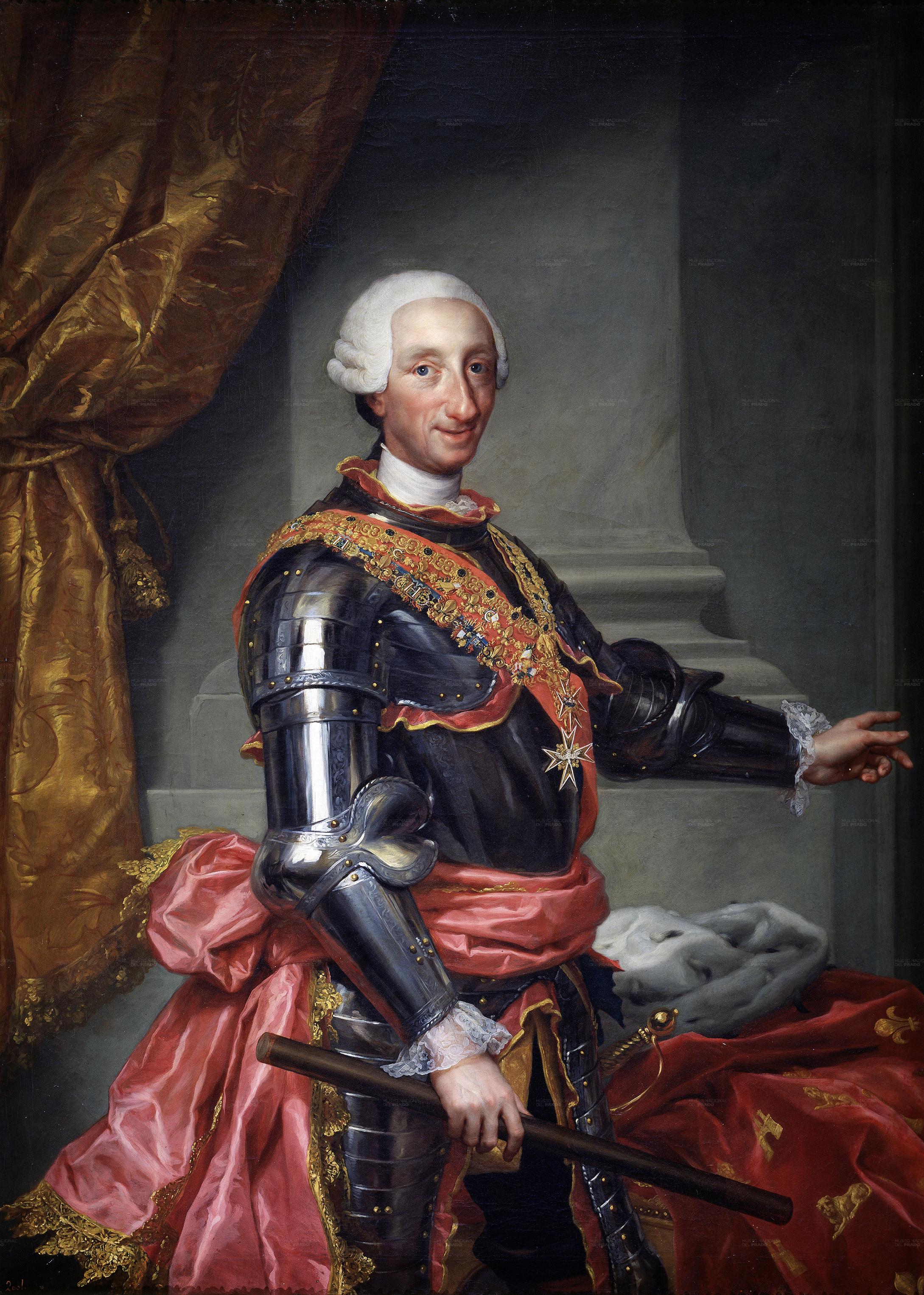
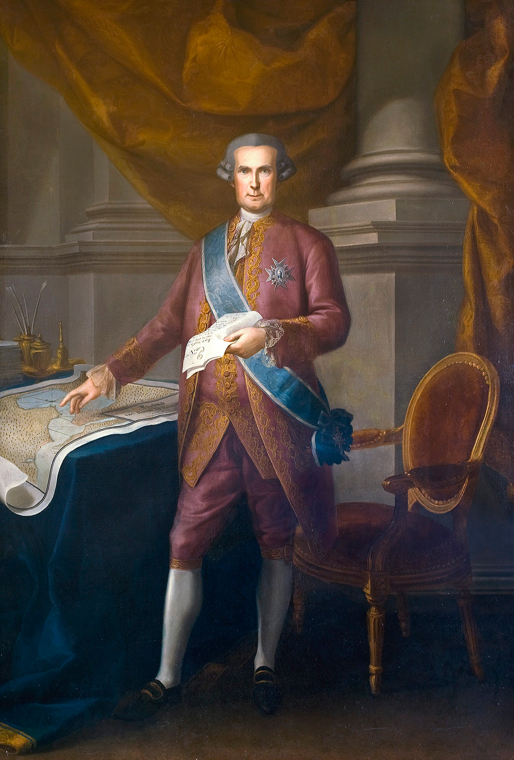
In 1767, King Charles III (1716–1788) expelled the Jesuits from all Spanish missions including those in Baja California, replacing them with Franciscan priests. The visitor general José de Gálvez (1720–1787), who was in charge of this process then turned his attention to Alta California and began plans to establish missions and settlements there.
The 1769–1770 Portolá Expeditions
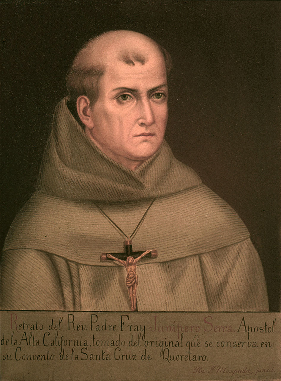
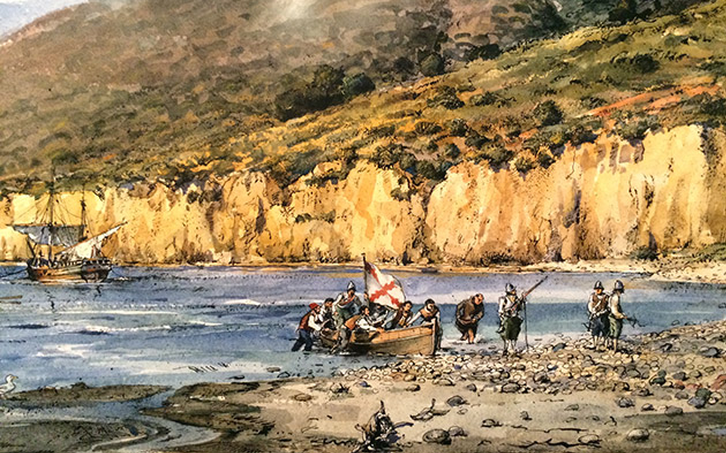
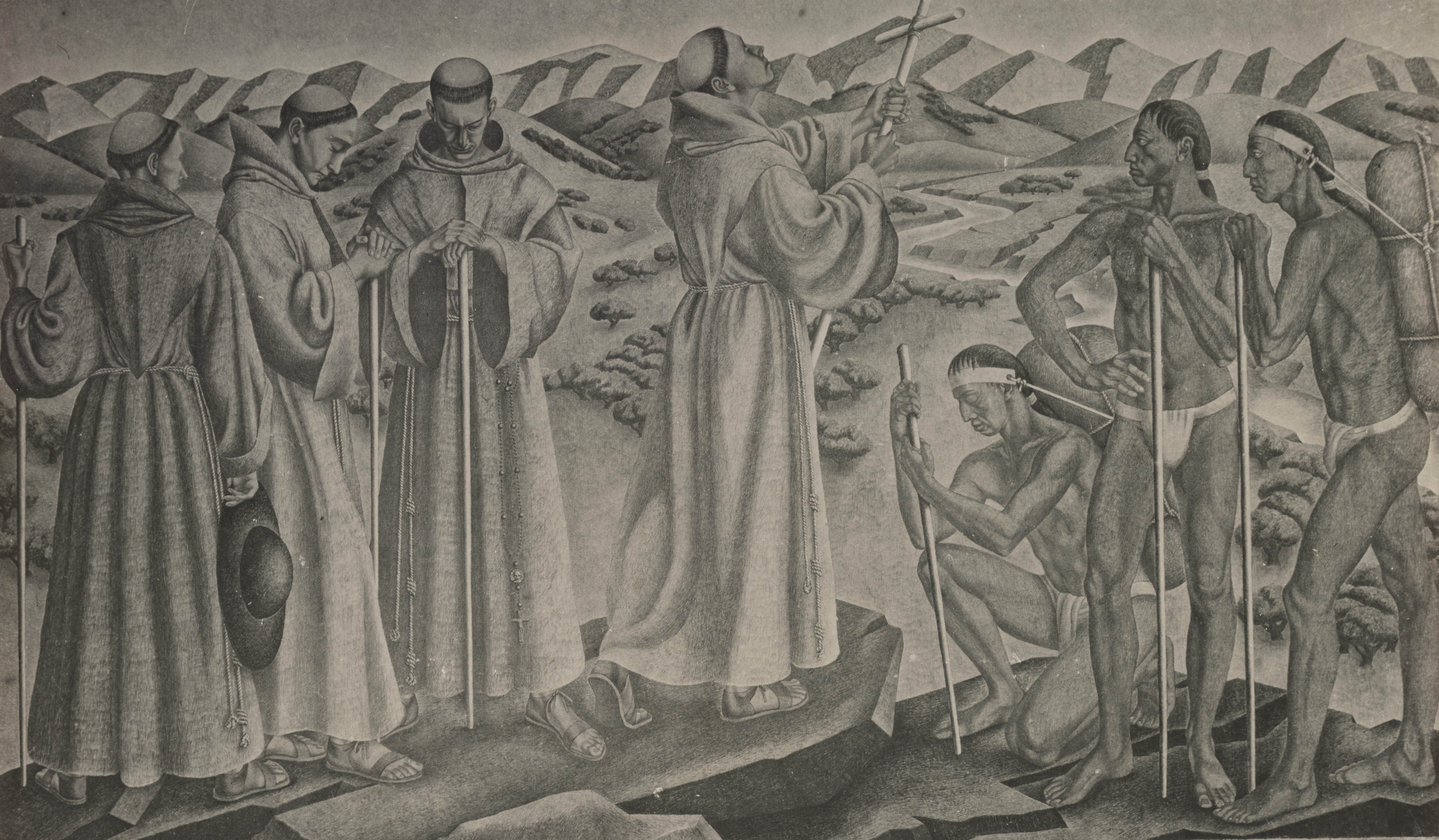
In 1769, two expeditions set out to establish the presidio and mission of San Diego: one led by Rivera y Moncada (1725–1781) and Father Crespí(1721–1782), another by Gaspar de Portolá (1716–1786) and Father Junípero Serra (1713–1784) — who would become President of the California missions. The San Diego Presidio was established May 14, 1769 and Mission San Diego de Alcalá on July 16 in Kumeyaay land.
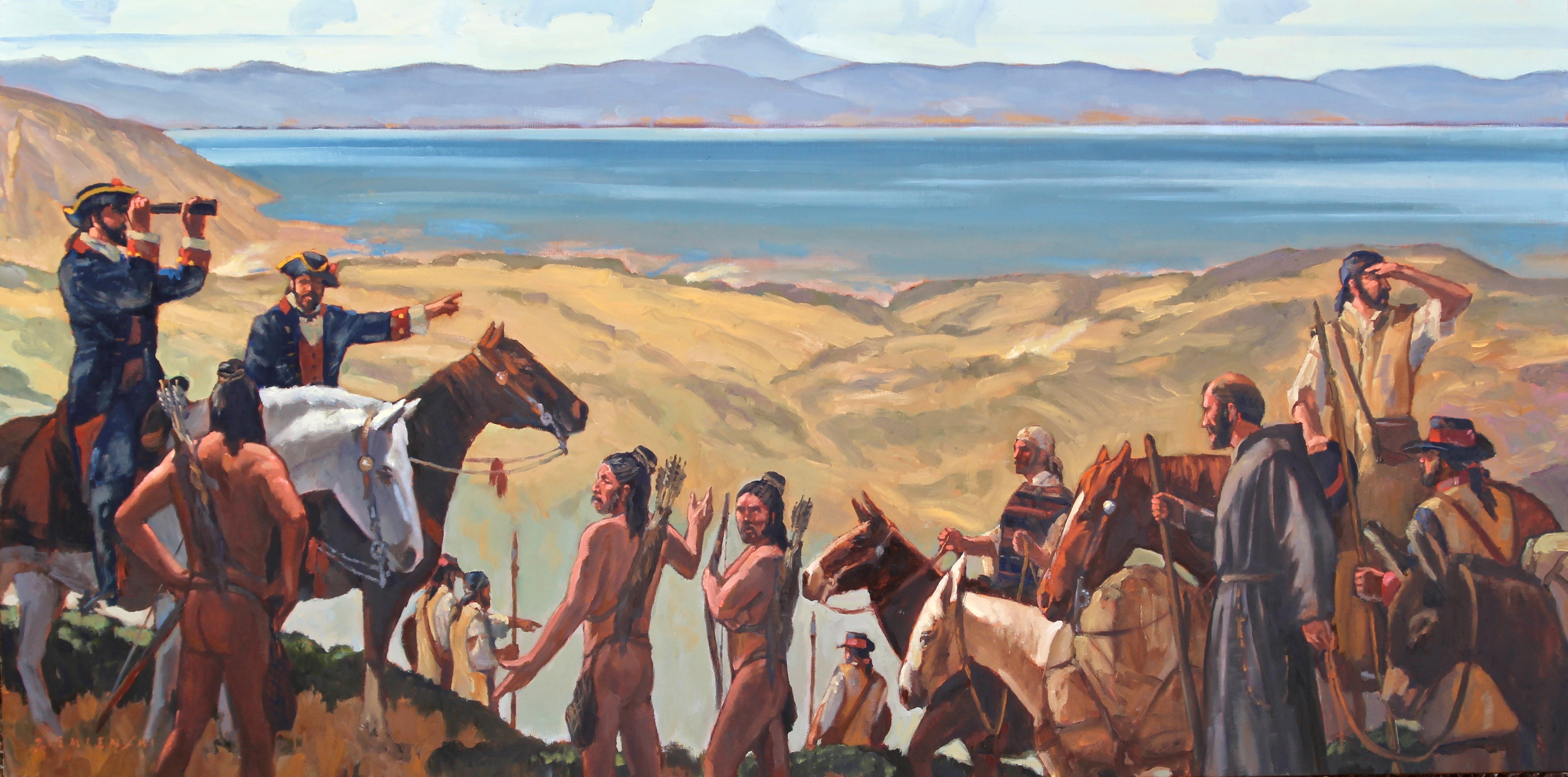
Portolá continued on with his party of 73 men northward in search of Monterey Bay, encountering many Indigenous nations and relying on them for help, trading glass beads and ribbons for food and guidance. They reached Monterey Bay but failed to recognize it, so Portolá pushed further north until, on November 2, 1769, scouts returned with the first Spanish account of San Francisco Bay and the Santa Clara Valley. A scouting party led by José Francisco Ortega (1734–1798) ventured as far as modern-day Hayward before Portolá himself viewed the Bay from Sweeney Ridge — now known as the San Francisco Bay Discovery Site. Engineer Miguel Costansó (1741–1814), upon seeing the Bay, called it a "magnificent estuary," while Father Crespí wrote it was "a very large and fine harbor, suchthat not only all the navy of our Most Catholic Majesty but those of all Europe could take shelter in it."
"[The scouts] said that to the north of the bay they had seen an immense arm of the sea or estuary, which extended inland as far as they could see… [and] they had seen some beautiful plains studded with trees; and that from the columns of smoke they had noticed all over the level country, there was no doubt that the land must be well populated…."-Miguel Costansó (1741–1814), expedition diary, November 2, 1769
Establishment of Monterey
Realizing they had overshot Monterey, Portolá returned to San Diego on January 24, 1770. Father Serra lamented: "You have come from Rome without having seen the Pope." On April 14, Portolá and Crespí set out again by land while Serra and Costansó sailed aboard the San Antonio, captained by Juan Pérez (1725-1775). Portolá's party reached Monterey Bay on May 24, finding a cross they had previously erected now surrounded by feathers, arrows, and offerings of fish and meat. The San Antonio arrived nine days later, blown far off course. Together, the Spanish founded the Presidio of Monterey and Mission San Carlos Borromeo. Portolá returned to New Spain, Pedro Fages (1734–1794) became acting governor of Alta California, and Monterey became the hub for further ventures and colonization of San Francisco Bay.
Attention Shifts to San Francisco Bay
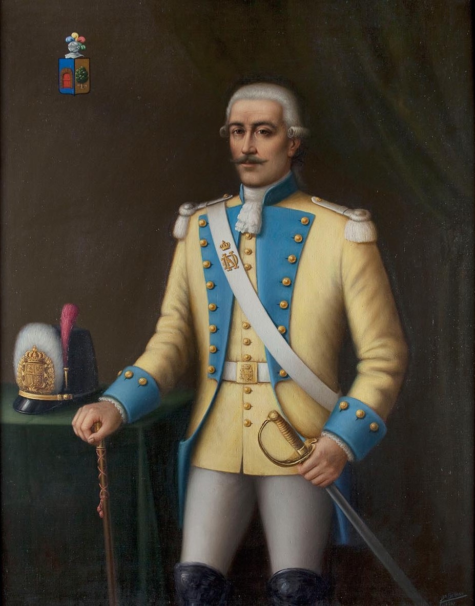
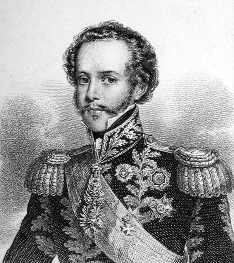
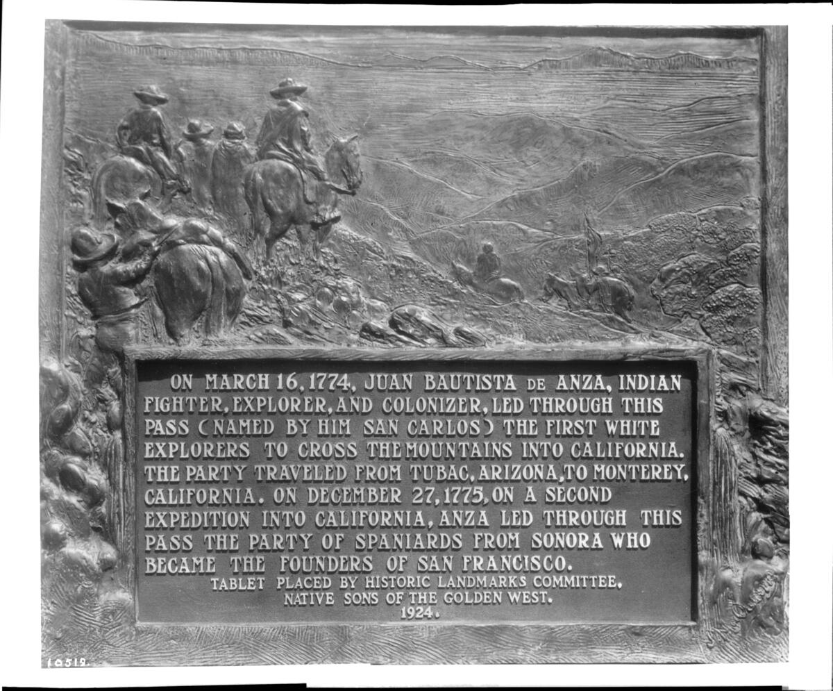
Military governor Pedro Fages set out on his own expedition November 21, 1770, passing through the Santa Clara Valley and becoming the first European to confirm that San Francisco Bay was connected to the Pacific through the Golden Gate. In 1772, Fages and Father Crespí returned to the East Bay, coming upon the Carquinez Strait and climbing Mount Diablo, where they observed the Sacramento-San Joaquin river delta flowing into the Bay from the Central Valley. Relations between Fages and Father Serra deteriorated over the soldiers’ abuse of the Rumsen Ohlone women, until Fages was replaced by Rivera y Moncada in 1774. That same year, Juan Bautista de Anza (1736–1788) established an overland route from New Spain to Alta California,forging friendly relations with the Quechan (Yuma) people along the way.
The Bay on the Eve of De Anza
Rivera y Moncada and Father Francisco Palóu (1723–1789) conducted the first extensive expedition up the Peninsula to present-day San Francisco, scouting sites for missions, a presidio, and a pueblo. On August 6, 1775 — just weeks before De Anza's expedition departed — the San Carlos became the first Spanish ship to enter San Francisco Bay, greeted by Ohlone and Miwok peoples in tule fishing boats. The stage was set for permanent settlement.
The De Anza Expedition to San Francisco, 1775–1776
Introduction
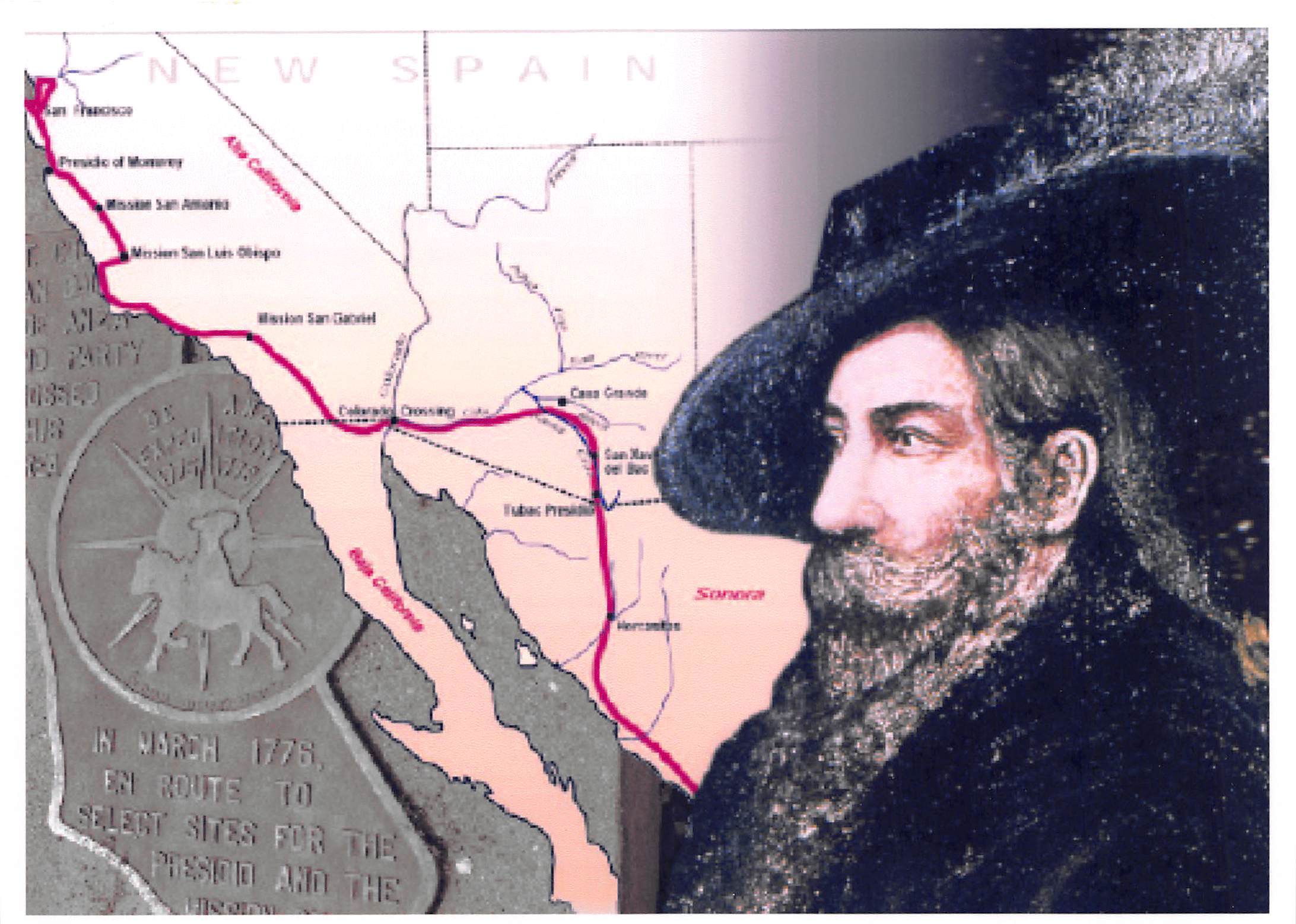
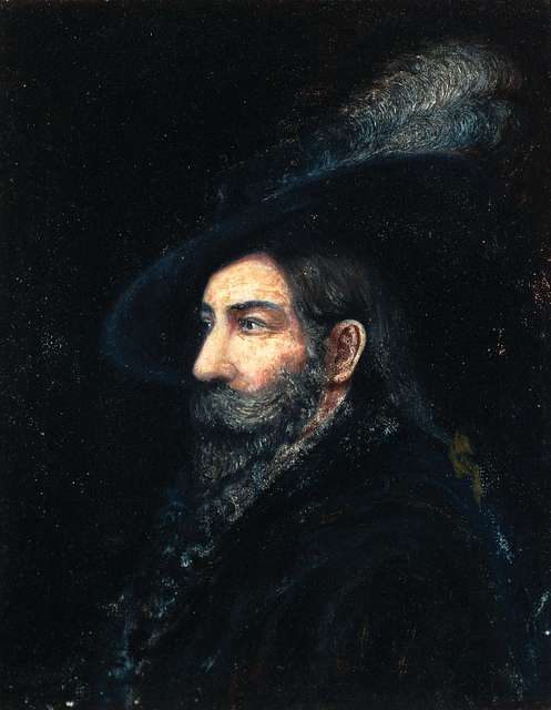
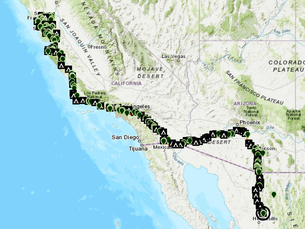
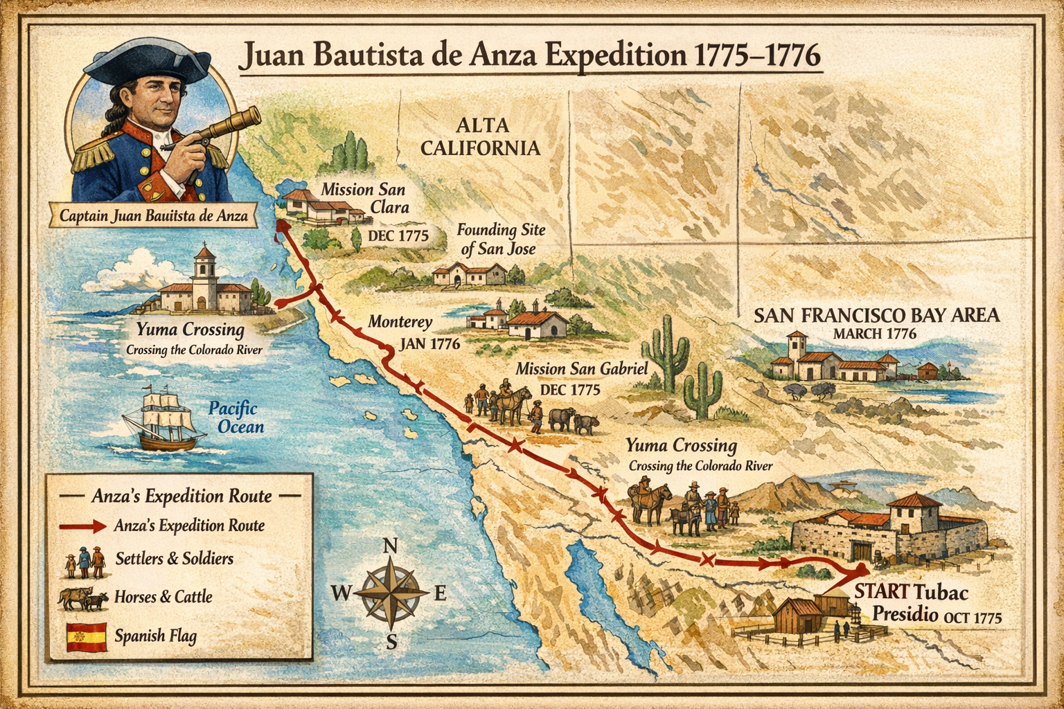
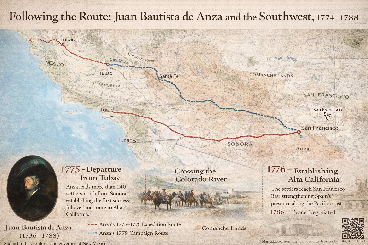
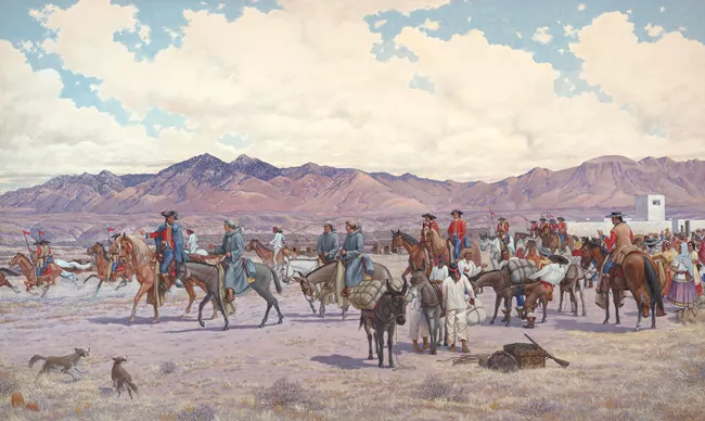
In the autumn of 1775, Lt. Col. Juan Bautista de Anza (1736–1788) led one of the most ambitious overland expeditions in North American history — marching 240 colonists from Sonora, Mexico across deserts, rivers, and snowy mountains to establish a Spanish presidio and mission in San Francisco Bay.
The six month journey covered nearly 1,800 miles. Along the way, the expedition endured dry deserts, brutal winter storms, the aftermath of conflict, desertion, and illness. It passed through the lands of dozens of Indigenous nations, whose cooperation and resistance shaped every step of the route. It brought soldiers, families, priests, and livestock into a vast territory to bring it under Spanish control.
The expedition would give Cupertino its name, leading to the establishment of San Francisco, San José, and Mission Santa Clara among others, and set in motion the Spanish colonization of the area. Many of the newly established California missions were collapsing due to food shortages and Indigenous resistance, and Father Junípero Serra (1713–1784) argued that settlers from New Spain were urgently needed to support them.
The Colonists
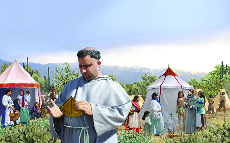
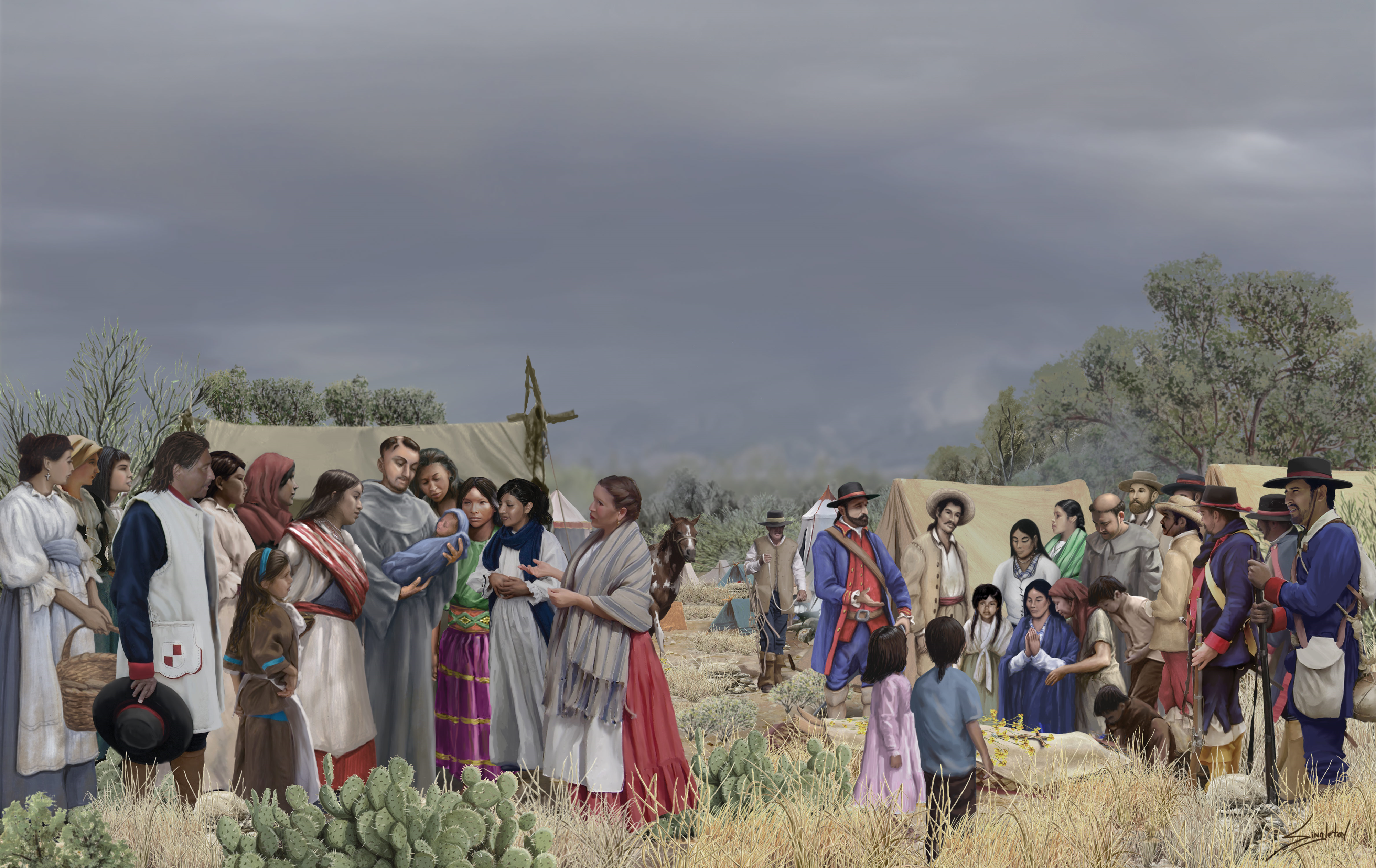
Throughout 1775, while the American War of Independence was kicking off on the other side of the continent, colonists were being assembled in Sonora, Mexico. The De Anza Expedition set out with 240 colonists — including 30 soldiers, 40 women, and more than 100 children — of diverse Indigenous, European, and African heritage. The expedition also included vaqueros, muleteers, servants, Indigenous guides, friars, 695 horses and mules, and 385 Longhorn cattle. Father Pedro Font (1737–1781) was the chaplain and diarist on the mission. Eight of the forty women were pregnant when the expedition set out. On the very first night,Manuela Peñuelas gave birth to a "very lusty boy" and died of complications the following morning — the only expedition member to die on the journey. Multiple women gave birth along the way, including on Christmas night, and De Anza repeatedly delayed the expedition so that mothers could recuperate.
Departure & Relations with Indigenous Peoples
After departing Tubac, Arizona on October 22, 1775, De Anza established firm policies against harming Indigenous peoples along the route.. Along the Gila River, villages of up to 1,000 people welcomed the expedition. Having previously negotiated peace among nations from the Gila to the Colorado River, the O'odham, Maricopa, and Quechan (Yuma) peoples regarded De Anza highly as a peacemaker — though he directed their appreciation toward King Charles III (1716–1788). The O'odham (Pima) — who found a mutual enemy with the Spanish in the Apache — likely desired an alliance and received the De Anza expedition warmly. All these groups put much effort into courting the favor of the Spaniards, feeding them well and entertaining them.
The Colorado River & Captain Palma
De Anza met Captain Salvador Palma, leader of the Quechan people, on November 27. Palma expressed a desire for the Spanish to settle among his people, and De Anza promised to bring him before the Viceroy in Mexico City — a promise with lasting consequences for Alta California. Crossing the Colorado River proved a great challenge until De Anza and a Quechan guide found where the river split into three shallower, manageable streams.
Snow, Cold & the Mountain Passage
After leaving Palma's territory on December 5, the expedition faced its most punishing stretch. Caught in a serious snowstorm at the foot of the Laguna Mountains, the party lost 60 to 70 animals to the cold, and delays on December 14–16 and 20–22 through Coyote Canyon cost them 50 more head of cattle. Lt. José Joaquín Moraga (1745–1785) was temporarily deafened in both ears from cold exposure. It was amid these brutal conditions that a boy was born on Christmas night. On January 4, 1776, the expedition finally reached Mission San Gabriel.
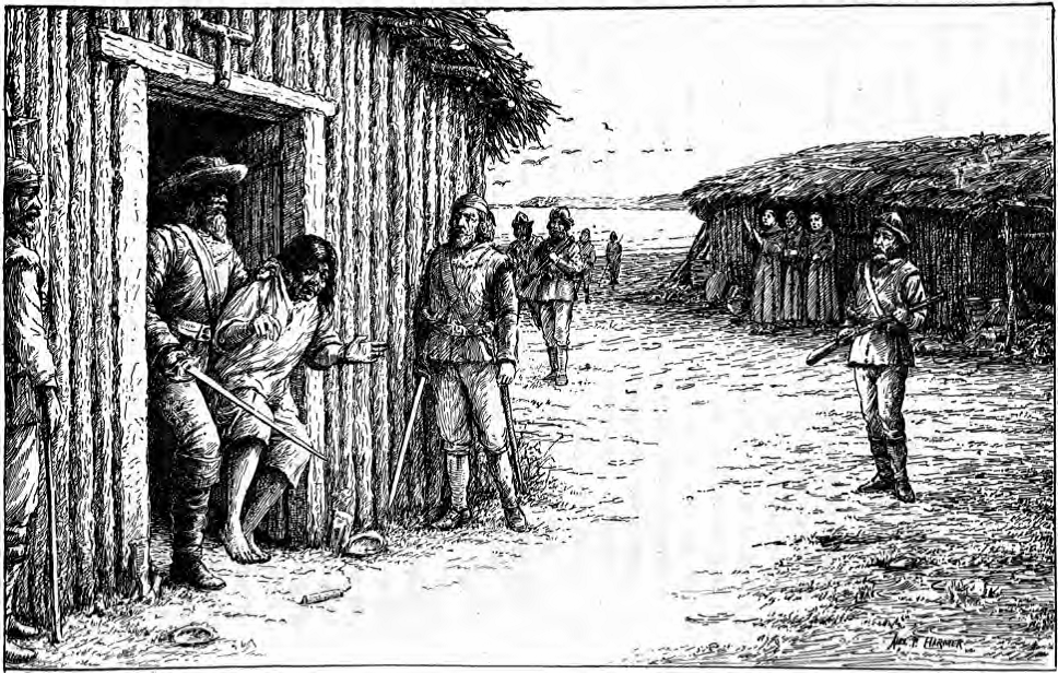
The Kumeyaay Revolt
On January 1, 1776, soldiers brought news that the San Diego mission had been attacked by Kumeyaay warriors on November 5 — killing Father Luís Jayme and setting fire to the mission. The Kumeyaay were upset that the Spanish were encroaching on their villages, disrupting their traditions, and making their people labor at the mission. The attack occurred while Lieutenant José Ortega (1734–1798)— a Portolá expedition veteran and the first Spaniard to see Santa Clara Valley — was away establishing Mission San Juan Capistrano. Fifteen of twenty-five nearby Kumeyaay villages contributed warriors, numbering as high as 600 — one of the most successful revolts against the Spanish missions in California.
De Anza and military governor Fernando Javier Rivera y Moncada (1725–1781) traveled together toSan Diego to address the revolt and prevent a second attack. On January 11, the day after Thomas Paine published his pamphlet Common Sense, the two commanders and their troops would arrive in San Diego. The investigation stalled as the weeks dragged and the principal leaders evaded capture. The two men quickly butted heads since De Anza was eager to return to his expedition, and Rivera was slow to act.
Deserters from San Gabriel
Returning to San Gabriel February 12, the expedition found that a soldier had deserted overnight — taking three muleteers, a servant, twenty-five of their best saddle animals, trade beads, tobacco, chocolate, and two muskets. The soldier had stolen from the commissary and, fearing discovery, convinced the others to flee. Lt. Moraga pursued and caught them some 10 miles from the Colorado River, where they surrendered without resistance. They were later sentenced to work at the Presidio of San Francisco after its founding.
Arrival in Alta California
After another pause of nine days, awaiting the return of Moraga,the expedition left San Gabriel, leaving orders for him to catch up, and followed the coast northward along the Portolá trail. Moraga wouldn’t catch up until March 7 at Mission San Antonio de los Robles. The expedition all together now finally arrived at the Presidio of Monterey on March 10, where Father Serra greeted them. At the mission, Font spent time with Fathers Palóu and Crespí — both veterans of earlier expeditions to San Francisco Bay — as preparations were made to scout further north. On March 13, De Anza fell suddenly and severely ill with debilitating pains and fever, but after delaying another week, he resolved to continue against doctor's advice.
Encampment at Cupertino & Scouting San Francisco
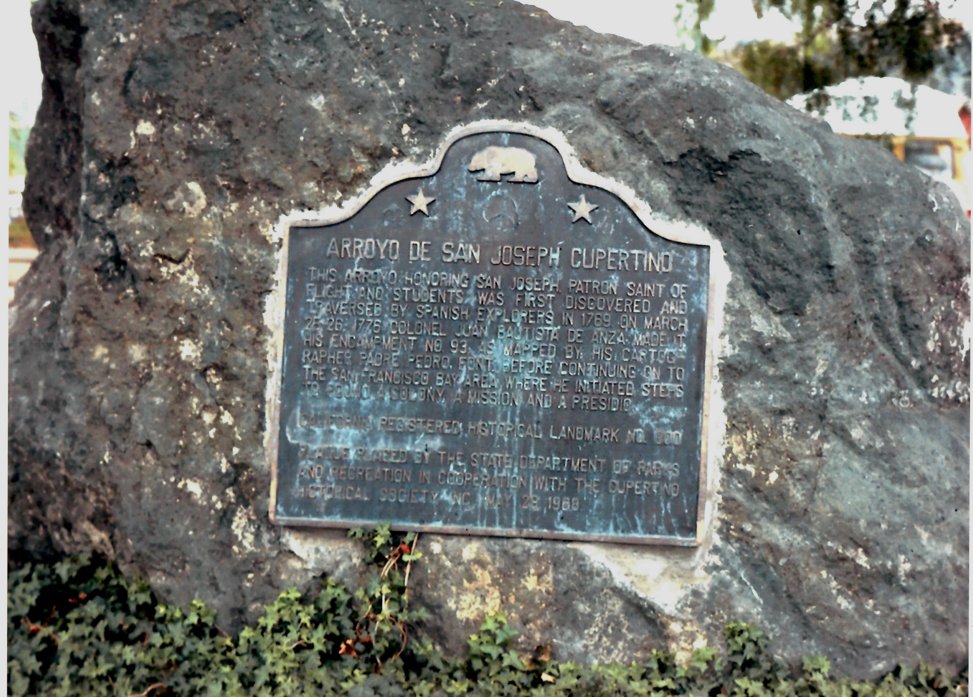
On March 25, 1776, De Anza encamped on the banks of Stevens Creek, which Font named the Arroyo de San Joseph Cupertino — the name that would give our city its name over a century later. On March 27, the party reached Fort Point, where De Anza looked out on the Golden Gate and erected a cross marking the future Presidio of San Francisco. On the 29th, a mission site was chosen at the Arroyo de los Dolores. The following day, Font measured a massive tree — 5.5 yards in circumference and 50 yards tall — that would come to be known as El Palo Alto, giving its name to the city of Palo Alto and featured on the Stanford University logo. It still stands today.
On March 25, 1776, De Anza encamped on the banks of Stevens Creek, which Font named the Arroyo de San Joseph Cupertino — the name that would give our city its name over a century later. On March 27, the party reached Fort Point, where De Anza looked out on the Golden Gate and erected a cross marking the future Presidio of San Francisco. On the 29th, a mission site was chosen at the Arroyo de los Dolores. The following day, Font measured a massive tree — 5.5 yards in circumference and 50 yards tall — that would come to be known as El Palo Alto, giving its name to the city of Palo Alto and featured on the Stanford University logo. It still stands today.— Father Pedro Font’s Complete Diary of the Second Anza Expedition, March 25 1776
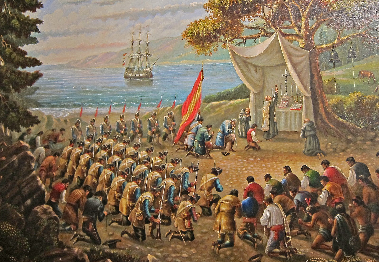
Founding of the Missions, Presidio, and Pueblo
De Anza never witnessed the founding of San Francisco. He, still suffering effects from his illness and waiting for permission to continue from Rivera,returned to Mexico City, leaving it to Lt. Moraga to establish the presidio. On the road back to Mexico, Rivera passed him by hurriedly with hardly a word, which De Anza took great offense to. Soon after, he would learn that Rivera had been excommunicated for dragging the rebel leader Carlos from church protection at swordpoint. The settlers were sorrowful to see him go. The first mass was said June 29, 1776, just before the Declaration of Independence was signed; the presidio was officially founded September 17; the mission on October 9. On January 17, 1777, Mission Santa Clara de Thamien was established on the Guadalupe River by Rivera where De Anza had noted as "a good place for settlement," and on February 3 Rivera was replaced in his position. On November 29, 1777, Moraga founded El Pueblo de San José de Guadalupe, the first civilian European settlement in San Francisco Bay.
The Mission Period in Santa Clara Valley, 1777–1836
Introduction
In the summer and into the fall of 1776, as the Declaration of Independence was being signed and George Washington was suffering defeats to the British fighting over New York City, Lt. José Joaquín Moraga (1745–1785) with Father Francisco Palóu (1723–1789) established the Presidio of San Francisco and Mission San Francisco de Asís with the colonists of the De Anza expedition.
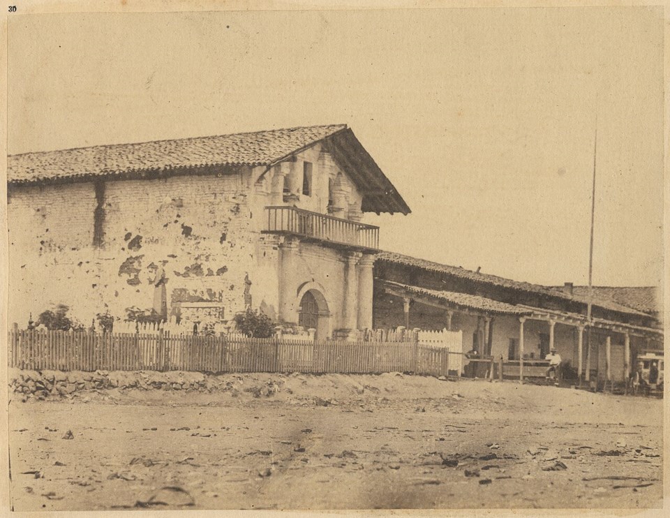
At the beginning of the next year, Moraga and Father Tomás de la Peña set out with colonists from San Francisco to establish a sister mission in the Santa Clara Valley. January 17, 1777 the Mission Santa Clara de Thámien was founded on the Guadalupe River near the Thámien village of Socoisuka. In November that year, El Pueblo de San José de Guadalupe was founded by Moraga. In January 1778, however, the mission was destroyed by a flood and relocated, which would be blessed by Father Junípero Serra as Mission Santa Clara de Asís November 11, 1778 before being abandoned again in 1784 in favor of the current site.
In 1781, the trail that De Anza had opened from Mexico to California was closed after relationships between the Spanish and Quechan soured, as they rose up and destroyed the mission established among them. Fernando Javier Rivera y Moncada lost his life in the hostilities. The trail would remain closed for 40 years, likely hindering the growth of Spanish California. That same year the combined Continental and French armies and navy would achieve their decisive victory against the British at Yorktown, assuring American independence. Neither coast would ever be the same again.
Establishment of Mission Santa Clara de Thámien
The mission initially had a small guard and their families, and a few padres. Father Tomás de la Peña was in charge of the mission. The construction attracted the local people who liked the gifts and trade the newcomers brought, though the Spanish thought of them as “greedy and thievish.” Once it became clear the Spanish intended to stay and control the area, the Thámien resisted by killing some of the Spaniards’ mules. Lt. Moraga went into their village to punish them; after the ensuing skirmish, he arrested their leaders and had them flogged at the mission.
Relationship to the Ohlone
When Mission Santa Clara was established, there were 40 Ohlone villages in the valley. The padres assigned them Spanish names, including the Thámien village designated as San Joseph Cupertino, the first name that has survived to the modern day of a settlement in Cupertino. The mission’s cattle herd grew from 100 cows in 1777 to 10,000 in 1803. Spanish livestock and farms grazed on the grains and seeds that the Ohlone ate, prompting conflict and hardship.
In 1782, the notorious Pedro Fages (1734–1794) became governor of Las Californias and led military expeditions against the Ohlone, giving his soldiers free reign to kill and torture unbaptized Indigenous people. The mission achieved little success converting the valley’s people. In the 1780s most baptisms were of children under 11, many of whom would not live to adulthood. Local elites and families tried to preserve their position by establishing relationships with the new Spanish order according to their own practices: sending children to enter into “apprentice relationships” where the padres performed the ritual of baptism.
These hardships caused the Ohlone population to collapse from over 20,000 to under 5,000 by 1800. By the end of the 18th century, all Thámien villages, including San Joseph Cupertino, would be left abandoned and their inhabitants absorbed into the mission system.
Life on the Mission
At the mission, the lives of the neophytes were highly regimented and they received religious instruction. Men worked in the fields and with animals, while women wove cloth, boiled fat for candles, and tended to the gardens. Unmarried neophytes lived in crowded dormitories where men and women were segregated where disease spread. Punishments were common; in 1786 Father Peña was tried for beating four neophytes to death, yet retained his position. Relations with the San José Pueblo were contentious, as non-baptized Ohlone traded and worked there contrary to the padres' orders.
Secularization of the Missions
After Mexican independence in 1821, Mexico began secularizing the missions. Though mission lands were legally held in trust for the missionized Indigenous people, in practice most were granted to wealthy Californios of largely European descent. Thus began the Rancho Period where parts of Cupertino were in Rancho Quito, granted to San José mayor José Noriega (1796–1869).
Legacy of De Anza
Introduction
Santa Clara Valley would drastically change once more with California becoming part of the United States after the Mexican-American War (1846–48). The lands devoted to herds of cattle and sheep would turn into vineyards and fruit orchards as newcomers flooded into the state.
The Arroyo San José de Cupertino would become Cupertino Creek and by 1859, a road was recorded as Cupertino Road (now Stevens Creek Blvd). In the 1870s, the Jesuits, now in ownership of the old Santa Clara Mission, purchased land along the canyon for a retreat and built the first chapel (1873) in the area dedicated to St. Joseph Cupertino. By the 1880s, the name Cupertino was losing favor to Stevens – named after pioneer Elisha Stephens (1804–1887) – and the agricultural community springing up around the Cupertino Crossroads was starting to be called West Side.
In 1881, however, the highly influential early resident John T. Doyle (1819–1906) established the Cupertino Wine Company on the banks of the creek. Doyle, like many others, seemed to have garnered an interest in the Cupertino-De Anza story as he was – among other occupations – a historian and re-established the name Cupertino, being given the first post office permit in 1883 in the up-and-coming village. From the 1910s on, Herbert E. Bolton (1870–1953) served as chair of the history department for twenty-two years at the University of California, Berkeley; his translations of original accounts from Spanish expeditionaries and padres prove invaluable to research of the beginnings of Spanish California.
Cupertino’s Greatest Mystery
In the aftermath of the 1906 earthquake, severe damage was done to the winery buildings owned by John T. Doyle, requiring ground excavations and structural repair. In the fall of that year, so the story goes, one Charles Rousten and his workmen unearthed a “greenish-grey colored plaque worn by time.” The teacher of the local San Antonio school, Susie A. Corpstein was passing through on her buggy when Rousten hailed her and told her what they had found. Corpstein then took the plaque to the school, where it was cleaned and examined for several days by her and her students.
The plaque was apparently made of lead, with neat lettering cut into its surface in Spanish. Despite not understanding much Spanish, they were able to discern the words “San Joseph a Cupertino,” “1776,” and “Anza.” Witnesses included students such as Mabel Noonan, who was in Corpstein’s buggy when it was first given to her, and Louis Stocklmeir among others. Corpstein advised Rousten to take it to the University of Santa Clara as a physical marker and proof that De Anza encamped on Stevens Creek, but it never made it there.
The whereabouts of the plaque after this point remain a mystery, even after Noonan’s attempts to trace it and contact Rousten and the Doyle family about it. Corpstein and her students were convinced of its authenticity, but there is no record in either Font’s or De Anza’s diaries of a plaque being left at campsite #93. Doyle, whose property the plaque was found on, was a historian and had an interest in recognizing the name Cupertino in the area. Ultimately, the authenticity of the plaque is unable to be proved unless it finally shows up again over a century after its discovery…
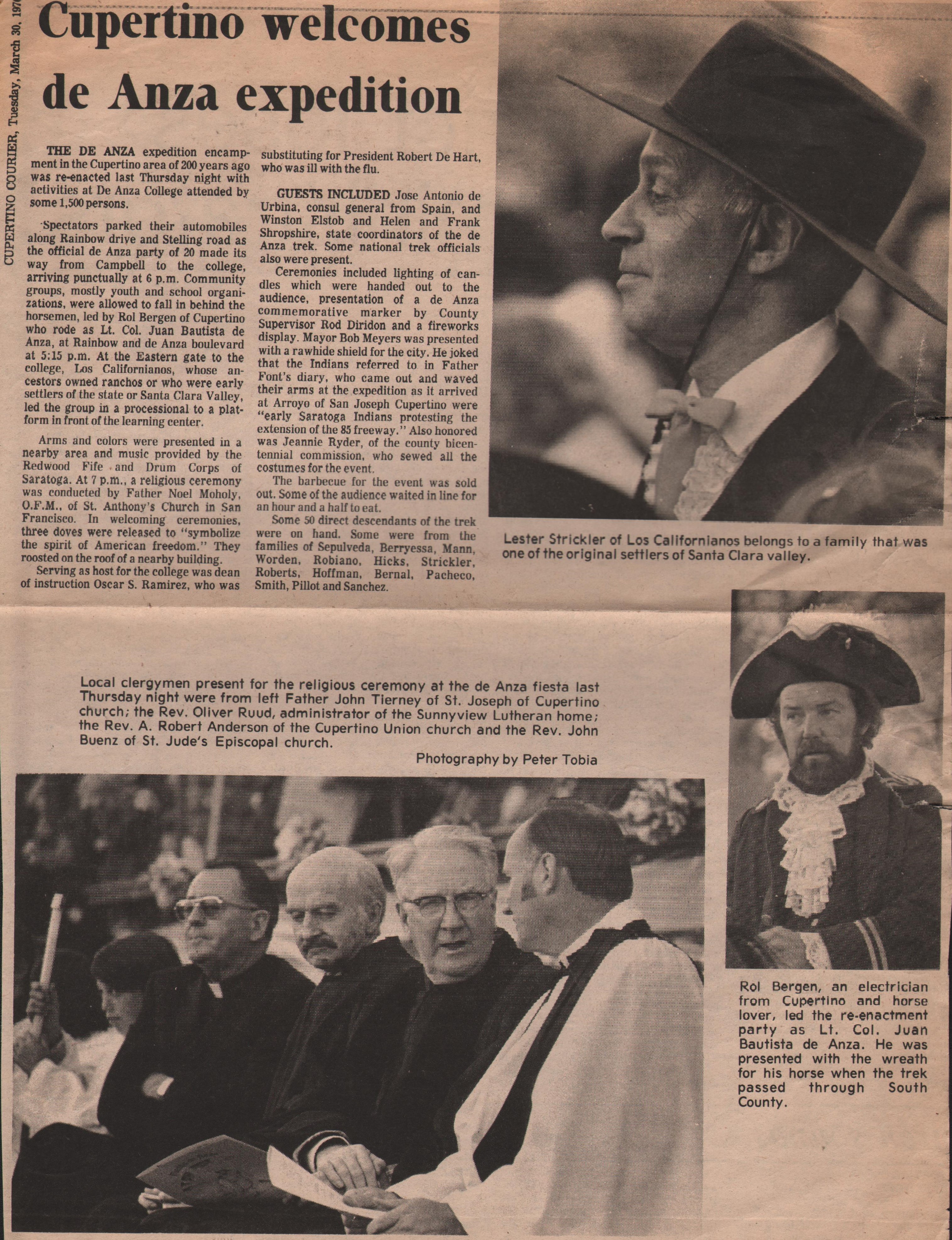
Renewal of Interest in De Anza’s Trek
During the 1960s, another wave of interest in the De Anza expedition began to take hold in Cupertino. Starting in 1963, Historian and co-founder of the Cupertino Historical Society Louis Stocklmeir and Courier artist A. Pete Emig were among those who led the charge in attaining official recognition of the significance of the expedition around the city.
In April that year, De Anza College was chosen as the winning name for Foothill College’s second campus out of 200 other suggestions. Shortly thereafter, Stocklmeir and Emig collaborated to provide material for a series of articles in the Cupertino-Monta Vista Courier about De Anza’s encampment in Stevens Creek and the missing plaque which were published throughout that year. On May 15, 1963, Cupertino became sister cities with Copertino, Italy.
Throughout 1964, efforts were made to establish a State Historical Landmark recognizing the campsite and in December, the state approved it as Historical Marker #800, and a plaque was set up at Monta Vista High School. In 1966, local Boy Scouts erected another plaque commemorating the historical event on the former Doyle property, and in 1967 De Anza College opened its doors to students.
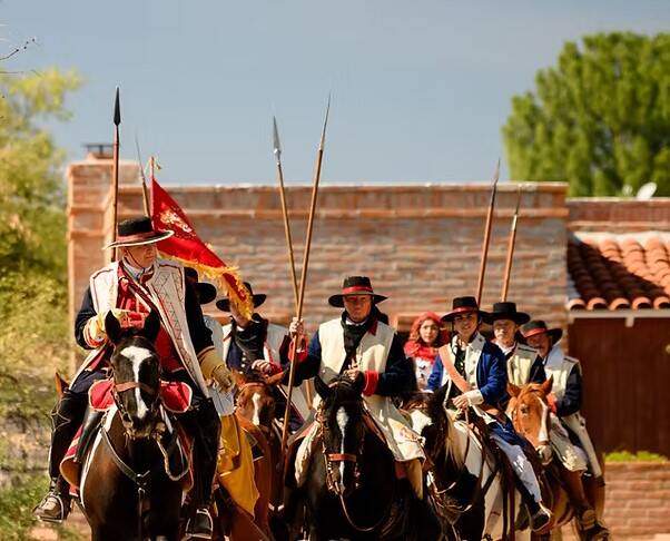
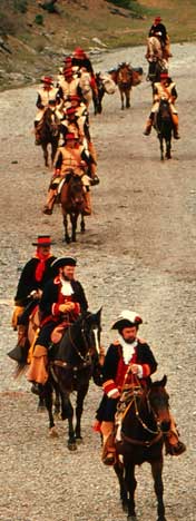
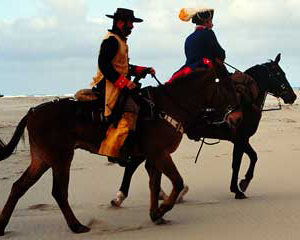
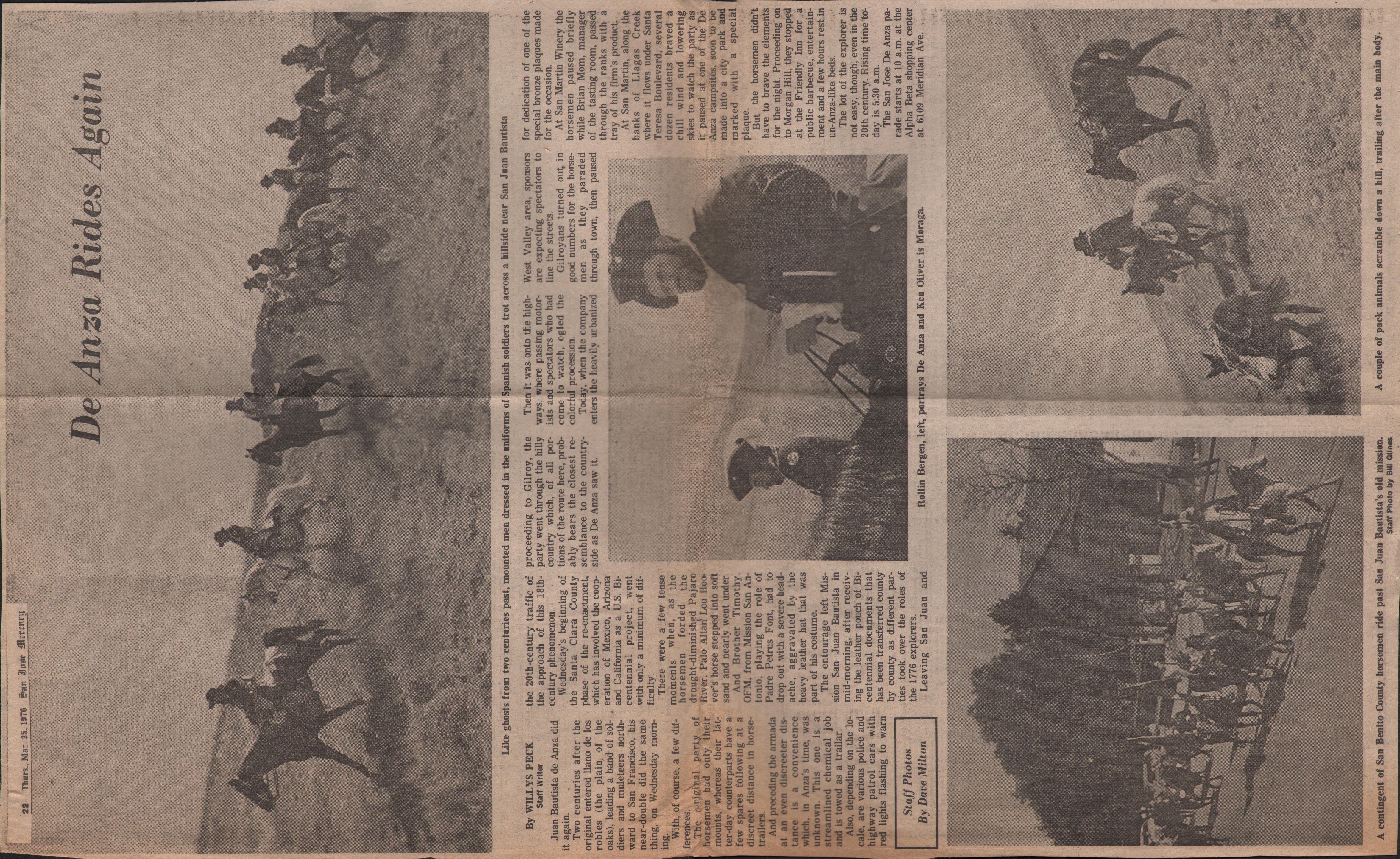
1976 Bicentennial Reenactment
In 1975 and 1976, as part of the celebrations of the dual bicentennial of the American Revolution and De Anza Expedition, a reenactment of De Anza’s trek was launched. It began on August 14, 1975 around the United States Embassy in Mexico City and ended April 7, 1976 in Monterey, picking back up again June 17–26 to mark Moraga’s journey with the colonists to found San Francisco.
The reenactment wended its way day-by-day through the Mexican state of Sonora and the American states of Arizona and California. Each county had its own set of reenactors who rode their own stretch of the journey, passing a copy of the Viceroy Bucareli’s Decree to found San Francisco like a baton in a relay race with celebrations and receptions being held all along the way.
The reenactment was a significant event in Santa Clara County, as De Anza’s party passed through thrice, alongside Moraga’s journey to San Francisco alongside his 1777 foundings of Mission Santa Clara and San José. The reenactment diaries provide wonderful insight into both the trials and tribulations of such a monumental journey, as well as offer the chance to reflect on the tremendous change that has befallen the region in the previous two hundred years.
"When we got to where the right-of-way designated for the future Highway 85 freeway is, we turned off Prospect Road and turned toward an open field at Rainbow Drive. Now I knew exactly how Anza must have felt when he said, ‘We were greeted by heathen as they came running across the field.’ Swarms of people ran across the field to greet us. Although we were tired and weary from our journey, when we saw these people anxious to greet us, and who had waited so long, we became excited all over again. At the foot of Rainbow Drive there must have been 400 people walking along Stelling Road with us…The Boy Scouts were supposed to greet us, but they were standing in awe of the spectacle. The bugler couldn’t get the bugle to his lips and the color guard couldn’t get the flag unfolded. Finally the flag went up the pole, the trumpet sounded, the cannon went off, and the festivities at De Anza College came alive. We dismounted our horses and were led to the rest area. Moraga, Brother Tim and myself were taken to the platform. I have never met so many people in all my life.
I was weary from the long ride and believing I was Anza I wondered what I was doing here in the twentieth century."
— Rol Bergen, reenactment diary, March 25, 1976
The Legacy Continues
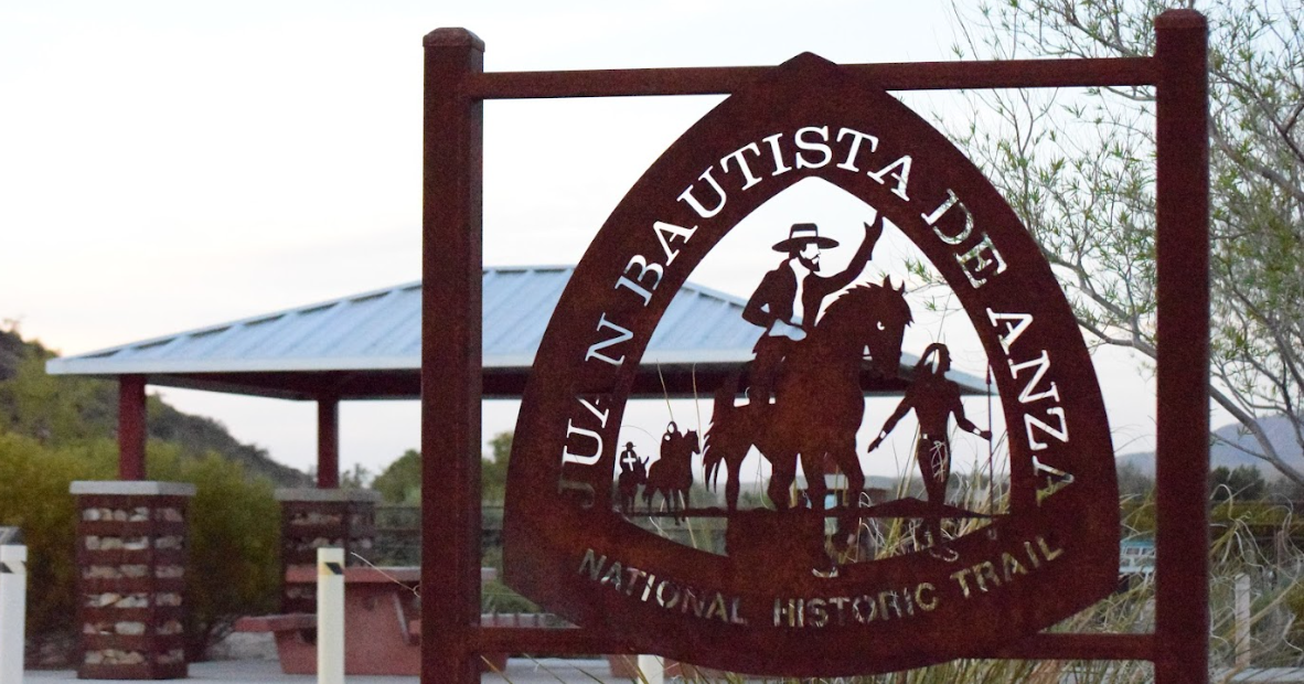
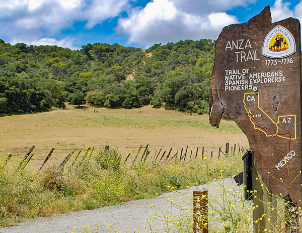
Saratoga was finally renamed to De Anza Boulevard in 1976. For years afterwards, individuals involved with the reenactment such as Joe Adamo and Jeanne Ryder formed the De Anza Lancers, who would visit schools and various events to communicate history as well as participate in minor reenactments such as that of the dedication of the De Anza Knoll Vista Point. In 1990, the National ParkService designated the Juan Bautista de Anza National Historic Trail, and in 1995 revealed in Cupertino plans to identify and landmark the historic route of the 1775-76 expedition.
The De Anza expedition marks a tremendous turning point in history, and its effects continue to the present. Descendents of the expeditionaries, colonists, and the Indigenous people they encountered along the way still live in the area, shaping its trajectory just as the expedition shaped their ancestors. Today, the legacy of the De Anza expedition continues in the everyday lives of Cupertino residents, and indeed Californians all over.